Heat waves are deadly and increasingly frequent. They hit urban areas harder than suburban or rural areas because cities have more heat-absorbing pavement, more buildings, and more people. But what if cities had a tool that could help them develop strategies to protect their citizens from deadly heat?
The City-Heat Equity Adaptation Tool (City-HEAT) is a decision tool that offers cities individualized, optimized strategies for reducing the urban heat island effect and its health impacts through modifications to the built and natural environments and reduction of people’s heat exposure.

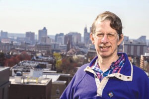
Ben Hobbs
It offers flexible decision-making that lets the user set priorities while also taking into consideration future uncertainties, says Ben Hobbs, the Theodore M. and Kay W. Schad Professor in Environmental Management in Environmental Health and Engineering, and one of the tool’s creators, along with PhD student and lead author Rui Shi. The work was published in Science Direct.
“[City planners] want to determine the best alternatives given conflicting objectives like equity, cost, and other considerations, combined with uncertainty around how climate change will advance and present itself, how long and how well certain tactics will work, and how urgently they need to address the problem,” says Hobbs, who is also a core faculty member with the Ralph O’Connor Sustainable Energy Institute.
For example, it can take a decade before tree planting makes a difference, whereas cooling centers, which offer air-conditioning and water to citizens in need, offer immediate relief from the heat. That distinction can be crucial for vulnerable populations, Hobbs notes, since heat and heat-related injury and deaths tend to be concentrated in poor and minority neighborhoods that have been underserved over decades, setting them up for greater consequences from heat events. They have less green space, more housing stock that is rundown, poorly ventilated, and lacks air conditioning, and populations with bigger health challenges and less access to health care, he says. The tool is currently “research grade,” which means that developers who are familiar with the tool can use it, but it needs a practical user interface that could be used by a layperson.
In simple terms, users input their objectives (reduce mortality, improve equity across neighborhoods, increase green space, minimize cost, etc.) as well as localized data on climate, demographics, geography, and temperature trends. The tool then suggests an optimal set of strategies based on the objectives and the data.
Baltimore will likely be the first city to benefit from the tool, which is being enhanced as part of Johns Hopkins 21st Century Cities Initiatives’ Baltimore Social-Environmental Collaborative, whose goal is to seek equitable climate solutions. That work is being conducted in cooperation with the Baltimore Office of Sustainability and community members.
This story was written by Danielle Underferth, and originally appeared in the Whiting School of Engineering Magazine.